Two proposed facilities, both with applications on file with the FCC. The contours below are computed with TVStudy v2.3.0 using the Longley–Rice terrain model over 360 radials. They are predictions for proposed facilities, not measured coverage — neither station is authorized or on the air.
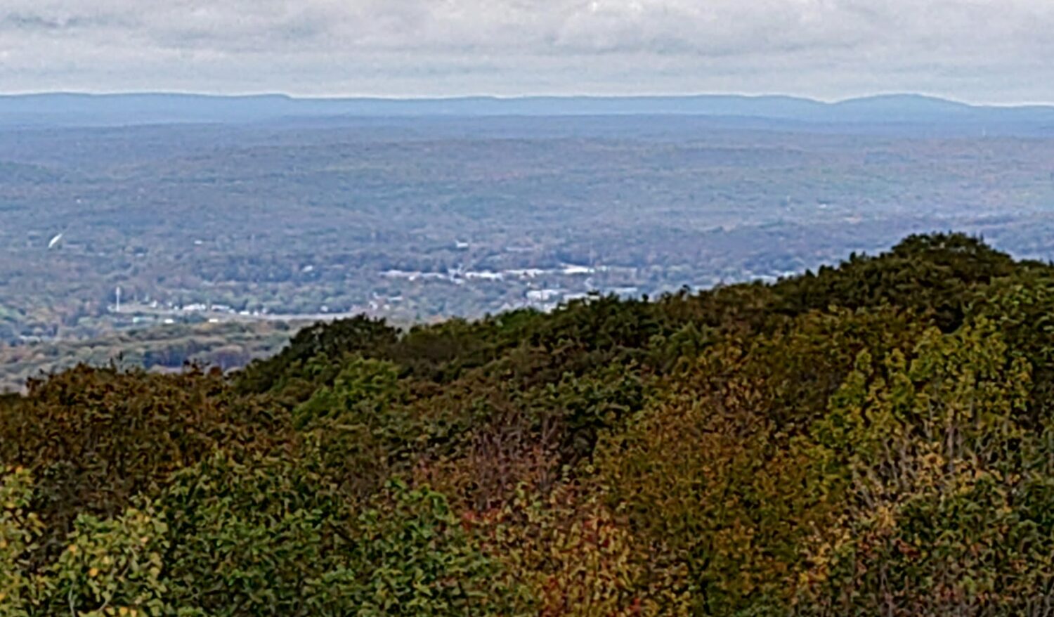
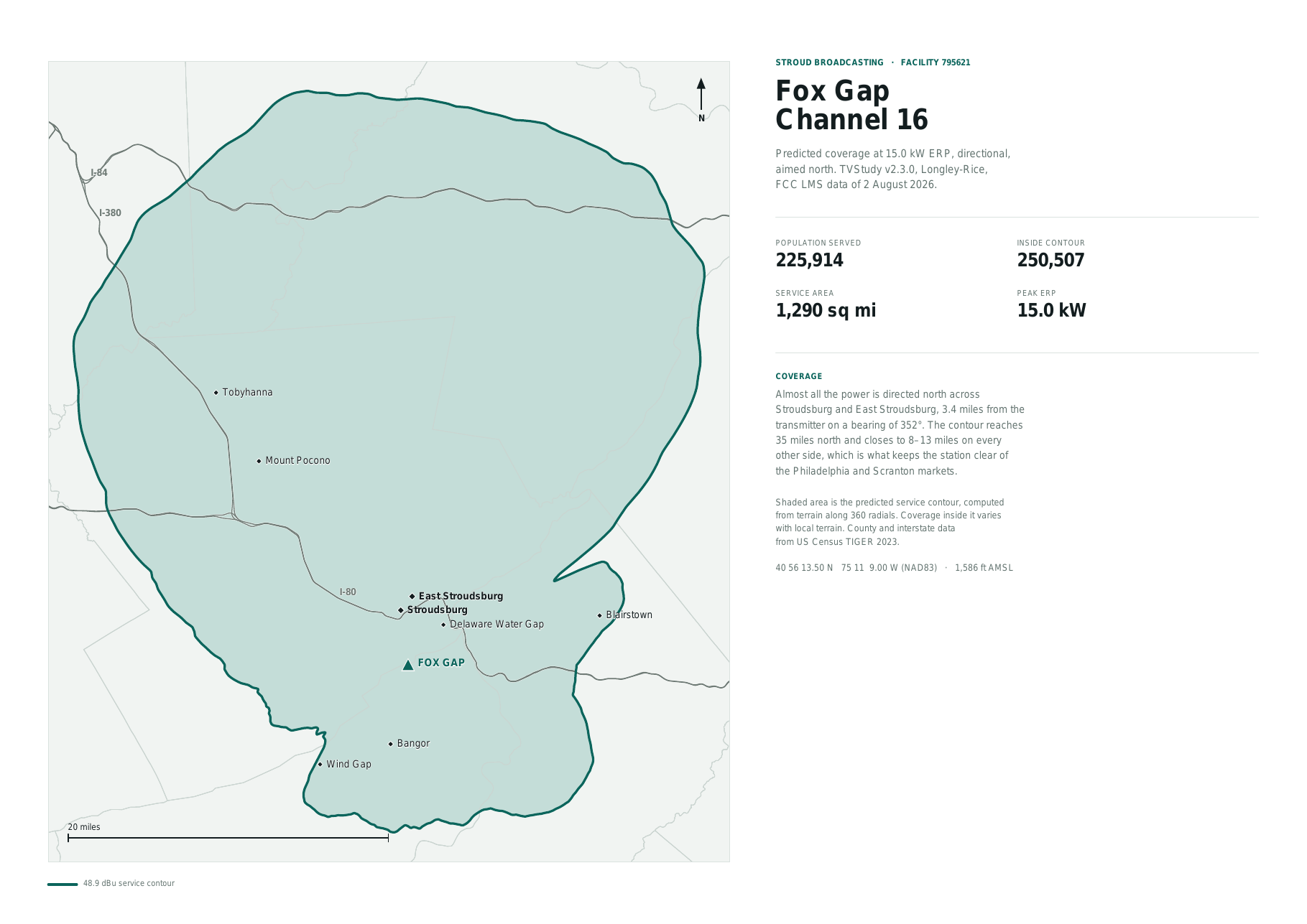
The contour shown is the 15 kW directional facility we intend to build, aimed north across Stroudsburg and East Stroudsburg. The application currently pending with the FCC (File No. 0000293831, Facility ID 795621) specifies a lower-power 200 W omnidirectional facility; the directional facility mapped here would be applied for by modification after a construction permit is granted. See the public notice for this application →
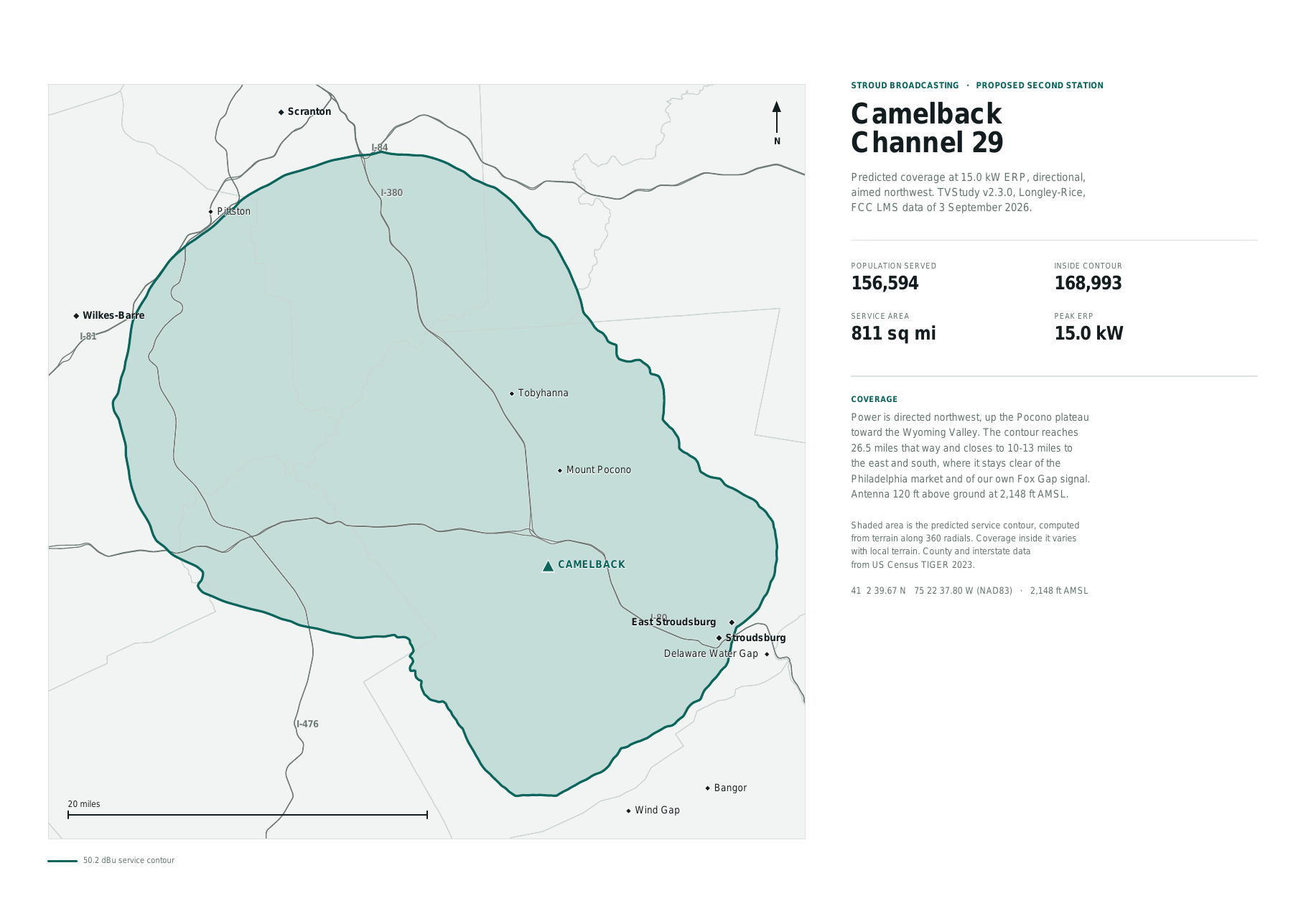
The contour shown is the 15 kW directional facility as filed, aimed northwest up the Pocono plateau toward the Wyoming Valley (File No. 0000303243, Facility ID 797468). See the public notice for this application →
County boundaries and interstates from US Census TIGER 2023. Coverage inside a contour varies with local terrain, antenna height and receiver quality.